How a Fish Finder Helps You Find Structure on Oklahoma Reservoirs
Ever feel like you're just casting blindly into the vast expanse of an Oklahoma reservoir, hoping for a bite, while other anglers seem to effortlessly pull fish from hidden spots? It's a frustrating experience many of us have had, especially on big, featureless-looking water where the fish just don't seem to be. This guide is all about demystifying one of the most powerful tools in an angler's arsenal: the fish finder, and how it can completely transform your approach to locating those secret, fish-holding structures that make all the difference.
The Challenge of Finding Fish-Holding Structure in Oklahoma Reservoirs
Let's be honest, Oklahoma's lakes are incredible, but they can also be incredibly daunting. From the sprawling depths of Lake Texoma to the vast, timber-filled arms of Lake Eufaula, these reservoirs are massive. Just looking at the surface, you often see nothing but water, and it’s easy to feel overwhelmed. How do you possibly find fish in all that water? The secret, as many seasoned anglers will tell you, lies beneath the surface – in the structure.
Why Structure Matters So Much for Anglers
Think about it from a fish's perspective. They need three things: food, oxygen, and protection from predators and harsh conditions. Structure provides all of this. It's their grocery store, their hiding spot, and their comfort zone. A submerged creek channel acts like a highway, a brush pile is a perfect ambush point for a hungry bass, and a rocky ledge provides cover from strong currents. Without structure, fish are exposed and vulnerable, and they tend to scatter.
On our big Oklahoma reservoirs, understanding where these underwater features are located is the difference between a productive day and a frustrating blank. Imagine trying to hunt deer in a perfectly flat, open field – not much cover, right? Now picture a dense forest with ravines and thickets. That's where the deer will be. Fish operate on a similar principle. They gravitate to changes in the bottom contour, submerged objects, and different types of cover. Anglers who consistently catch fish aren't just lucky; they understand how to find and interpret this structure. Without that knowledge, you're essentially guessing, and nobody likes to spend a day on the water just guessing.
The Limitations of "Eyeballing It" on Big Water
For centuries, anglers relied on visual cues, maps, and even just local knowledge to find fish. While these methods still hold value, especially for bank anglers or those in very shallow, clear water, they fall short on the immense and often murky depths of Oklahoma's reservoirs. You simply cannot see what's happening ten, twenty, or even fifty feet below your boat. You can look for subtle changes on the surface like ripples, current breaks, or diving birds, but these only tell a fraction of the story.
Trying to pinpoint a submerged hump in the middle of Lake Keystone without electronic help is like trying to find a needle in a haystack while blindfolded. You might accidentally drift over something good, but it's not a repeatable, strategic approach. This is where the old-school methods hit their limit, and modern technology steps in to give us an undeniable edge. Relying solely on your eyes leaves too much to chance, and it leaves a lot of good fish-holding structure undiscovered beneath the surface.
Understanding How Fish Finders "See" Underwater
So, how does this magical device peering into the depths actually work? It's not magic, it's science! Fish finders use sonar technology, which is essentially sound waves, to paint a picture of what's beneath your boat. Once you grasp the basics, the images on your screen start to make a lot more sense, and you'll be able to interpret them like a seasoned pro.
Sonar Basics: Sending and Receiving Pings
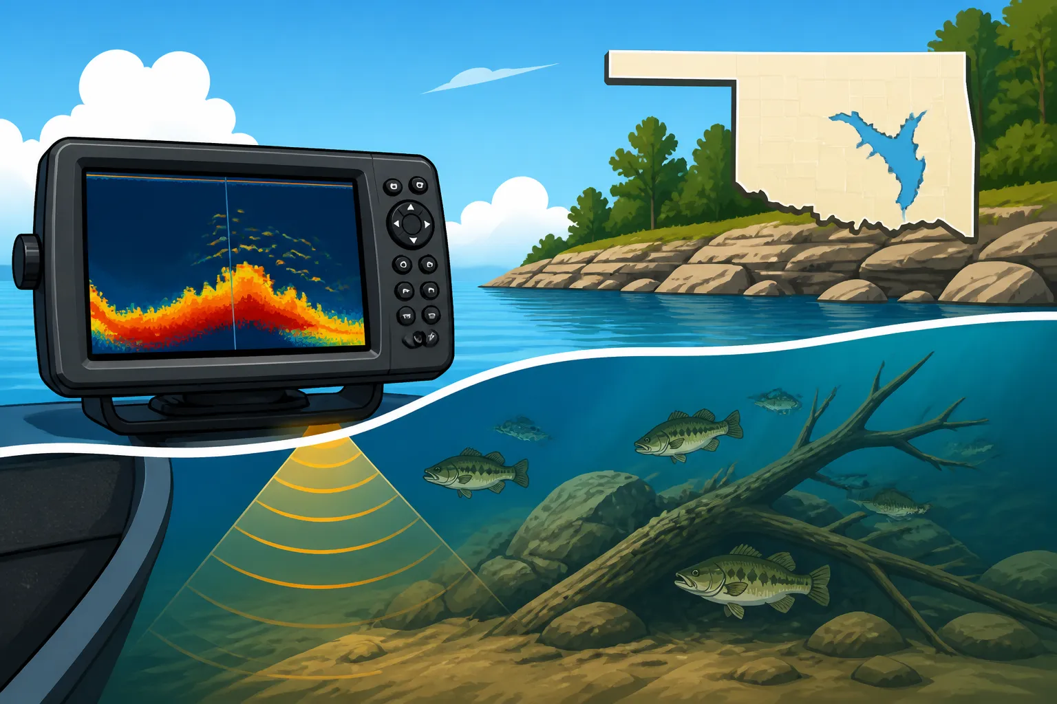
At its heart, a fish finder consists of a transducer, which is typically mounted on your boat's transom, hull, or trolling motor. This transducer sends out pulses of sound energy – often called "pings" – into the water. These sound waves travel down until they hit something, whether it's the lake bottom, a submerged tree, a school of baitfish, or even a single lunker bass. When these sound waves hit an object, they bounce back to the transducer, which then acts as a receiver.
The fish finder unit then measures two key things: the time it took for the sound wave to travel down and back up (this tells it the depth of the object), and the strength of the returning echo (this tells it how dense or hard the object is). A soft, muddy bottom will return a weaker signal than a hard, rocky bottom. This information is then processed and displayed visually on your screen, updating constantly as your boat moves. It's like shouting into a canyon and listening for the echo – the time it takes and the loudness of the echo tell you a lot about the canyon's size and features.
Interpreting the Screen: What Those Arches and Lines Mean
When you look at a traditional 2D sonar screen, you'll often see a mix of lines, shapes, and sometimes "arches." The bottom of the lake is usually represented by a solid line, and the thickness and color of this line can tell you about the bottom composition. A thick, vibrant line often indicates a hard bottom (rock, gravel), while a thinner, fuzzier line might suggest a soft, muddy bottom.
Fish often appear as arches or partial arches. This is because the transducer sends out a cone-shaped beam. As a fish moves through that cone, it's first hit on the edge of the cone, then more directly in the center, and then on the trailing edge. This changing distance creates the arch shape. The larger and thicker the arch, generally the bigger the fish. Schools of baitfish, on the other hand, often show up as dense clouds or clumps on the screen. Learning to differentiate between these signals is crucial. For instance, a big, distinct arch hovering near a submerged tree could be a trophy bass, while a fuzzy cloud might just be shad. It's a language you learn over time, but it's incredibly rewarding when you start "seeing" the underwater world with clarity.
Different Sonar Views: 2D, DownScan, SideScan
Modern fish finders offer a variety of sonar views, each providing a unique perspective of the underwater environment. Knowing which view to use and when can significantly improve your structure identification game. You can find many of these advanced units at retailers like Bass Pro Shops or online through Amazon.
- 2D Sonar (Traditional Sonar): This is the classic view, showing a cone directly below your boat. It's excellent for identifying fish arches and general bottom contours. It gives you good depth penetration and is often the primary display for quick checks.
- DownScan Imaging (or DownVu/ClearVü): This technology provides a much more photographic, picture-like view of what's directly beneath your boat. Instead of arches, fish appear as distinct blobs or shapes, and submerged objects like brush piles, stumps, and rock formations are rendered with incredible detail. It uses a much narrower, high-frequency beam, almost like an X-ray, to show you crisp images. It's fantastic for confirming what those fuzzy blobs on your 2D sonar actually are.
- SideScan Imaging (or SideVu/StructureScan): This is where things get really exciting for structure hunters. SideScan sends beams out to the sides of your boat, covering a much wider area than 2D or DownScan. It can show you structure and fish off to your port and starboard, often hundreds of feet in each direction. This allows you to quickly sweep large areas of water, revealing hidden creek channels, long ledges, entire fields of standing timber, or brush piles that you might have otherwise missed. It creates incredibly detailed images, often showing the shadows cast by underwater objects, giving them a 3D appearance. Many anglers consider a good SideScan unit essential for effectively covering large Oklahoma reservoirs. If you're looking for Best Side Imaging Fish Finder for Bass Fishing, this technology is usually at the core of it.
Understanding the strengths of each view and how to switch between them or display them simultaneously is key. For example, you might use SideScan to quickly locate a promising submerged ridge, then switch to DownScan to get a detailed view of its composition and any fish holding tight to it.
Using Your Fish Finder to Identify Key Structure
Now that we understand how fish finders work, let's dive into the practical application: using them to actually find the prime structure that holds fish. This is where your investment in good electronics truly pays off, transforming you from a random caster into a strategic angler.
Locating Ledges, Humps, and Drop-Offs
Ledges, humps, and drop-offs are some of the most consistent fish-holding structures in any reservoir. They represent changes in depth, creating ambush points, current breaks, and distinct depth transitions that fish love. Your fish finder is your best friend for locating these.
When you're cruising a lake, watch your 2D sonar for subtle changes in the bottom line. A sudden, sharp drop indicates a ledge or a channel edge. A gradual rise and fall suggests a hump. With DownScan, these features will appear even more defined, showing the exact slope and texture of the bottom. For example, on a lake like Grand Lake O' the Cherokees, bass and crappie will often position themselves right on the edge of a deep channel or along a rocky ledge, waiting for baitfish to swim by. Your fish finder will show you not only the drop-off itself but often the fish suspended right above or along its face. This is particularly crucial when targeting species like striped bass on Lake Texoma, where they often relate to deep submerged structure. Best Fish Finder for Deep Water Striped Bass on Lake Texoma can make a huge difference here.
Pinpointing Brush Piles and Standing Timber
Submerged brush piles and standing timber are absolute magnets for many species, especially crappie and bass. These can be natural remnants from when the lake was flooded or intentionally placed by anglers. Without a fish finder, finding these can be incredibly difficult, often relying on snagging your lure on them first!
With SideScan, you can often spot these isolated cover pieces from a good distance away, looking like distinct "trees" or "clumps" on the side-view screen. Once you identify a promising pile, you can then idle over it, using your 2D and DownScan to get a precise vertical view. DownScan, in particular, will render the individual branches of a brush pile, and you'll often see distinct fish targets nestled right in the thickest part of the cover. Imagine seeing a dense, submerged cedar tree on your screen, and then seeing several bright arches right within its branches – that's a tell-tale sign of active fish. You can then mark that spot with your GPS (a feature found on many units, and essential if you're asking Do You Need a GPS Fish Finder for Oklahoma's Big Lakes?) and return to it later.
Finding Rocks, Riprap, and Hard Bottom Areas
Rocks, riprap (the large rocks used to protect shorelines and bridges), and other hard bottom areas are also prime real estate for many species. They absorb and radiate heat differently than soft mud, and they provide excellent habitat for crawfish and other forage. Your fish finder can help distinguish these areas.
On 2D sonar, a hard bottom will typically show as a thicker, more intense bottom line with a strong secondary echo directly below the main bottom reading. This secondary echo is the sonar ping bouncing off the hard bottom, then reflecting off the surface of the water, and then bouncing off the hard bottom again before returning to the transducer. It's a distinctive "double bottom" signal. With DownScan, rocks will appear as clearly defined shapes and textures on the bottom. SideScan can reveal long stretches of riprap along a dam or causeway, or entire fields of scattered boulders, providing a wide view of these important habitats. Being able to quickly identify these bottom compositions allows you to present your baits and lures in the most effective way for the fish holding there.
Maximizing Your Fish Finder's Potential for Oklahoma Fishing Success
Having a fish finder is one thing; using it to its full potential is another. It's a powerful tool, but like any tool, it requires practice and a strategic approach. It's about combining technology with your angling instincts to unlock new levels of success on Oklahoma's diverse waters.
Combining Sonar with GPS for Waypoints
Modern fish finders are almost universally integrated with GPS technology, and this combination is incredibly powerful. When your sonar reveals a promising piece of structure – be it a brush pile, a sharp ledge, or a subtle hump – you can instantly mark it as a "waypoint" on your GPS. This simple act is revolutionary. Instead of trying to remember landmarks or triangulate your position, you now have the exact coordinates saved.
This means you can come back to that exact spot time and time again. You can create a "milk run" of productive waypoints over an entire season. If you find a few brush piles holding crappie on Lake Eufaula, mark them. If you locate a deep rock pile where you consistently catch bass on Lake Murray, mark it. Over time, you'll build up a personal map of hot spots. This also helps you understand seasonal patterns – for instance, if a particular hump holds fish in the spring, but they move off it by summer, your waypoints can help you track those movements. You'll often find that the Best Fishing Spots in Oklahoma are known to anglers precisely because they've used their electronics to identify and return to productive structure.
Reading Depth, Temperature, and Fish Arches
Beyond just showing you structure, your fish finder provides crucial environmental data. Always pay attention to the depth reading. Fish relate to specific depths depending on the time of year, water temperature, and sunlight penetration. Many units also display water temperature, which is arguably one of the most critical factors influencing fish behavior. Small changes in water temperature can signal where certain species, like bass during their pre-spawn phase, are most active. Learning How to Read Water Temperature for Better Fishing in Oklahoma is vital.
Furthermore, getting better at interpreting those fish arches on your 2D sonar or the distinct fish shapes on your DownScan takes practice. Are they suspended high above the structure, or are they tucked tight into it? Are they actively chasing baitfish (often seen as a "bait ball" with larger arches around it), or are they more dormant? The size and clarity of the arches can give you clues about the species and size of the fish. Don't just look for fish; observe their behavior in relation to the structure. This holistic approach, combining depth, temperature, structure, and fish activity, provides a complete picture of the underwater world.
Practice Makes Perfect: Getting to Know Your Unit
Like learning to drive a boat or cast a baitcaster, mastering your fish finder takes time and practice. Don't expect to be an expert after one trip. Spend time idling over known structure, experimenting with different settings, and observing how the screen changes. Go to a familiar spot where you know there's a brush pile or a submerged roadbed and see how your unit displays it. Read your owner's manual – yes, really! Many anglers overlook this valuable resource.
Consider watching online tutorials specific to your brand and model. Many companies, and even fellow anglers, share great tips for optimizing settings for clarity and target separation. The more time you spend with your unit, the more intuitive it will become. Before you know it, you'll be navigating the depths of Oklahoma's Best Lakes for Fishing with confidence, identifying key structure, and making more informed decisions about where to cast your line. Remember, a fish finder is an aid, not a magic wand. It enhances your abilities as an angler, but it still requires your skill and interpretation to truly unlock its potential.
| Sonar Type | Best For | Strengths | Limitations |
|---|---|---|---|
| 2D Traditional Sonar | General depth, fish arches, bottom contours | Excellent depth penetration, good for identifying suspended fish, fast refresh rate | Less detailed image of structure, can be cluttered with noise |
| DownScan Imaging | Detailed views of structure directly beneath boat | Photographic-like clarity for brush piles, stumps, rock formations, bait schools | Narrow beam, only shows what's directly below, not good for wide area scanning |
| SideScan Imaging | Wide area coverage, scouting large sections of water | Reveals structure off to the sides (ledges, channels, isolated cover), highly detailed | Not ideal for direct vertical depth, requires boat movement to "paint" the image |
This article is for general informational purposes only and does not constitute professional advice. Laws, prices and regulations vary by location and change over time. Consult a qualified professional for guidance on your specific situation.